A Boundary Follows the Land, Until It Does Not
County boundaries can follow rivers and ridgelines, but records and terrain may diverge. Learn how to read both without mistaking a landscape for a legal line.
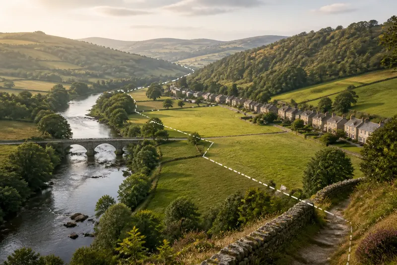
A county boundary can follow a river for miles, then cut across fields where the water bends away. Reading county boundaries means treating rivers and ridgelines as useful orientation—not as proof that the political line follows every visible feature. A careful reader asks where terrain offers a clue, where a map records a different choice, and what evidence can settle the question.
Consider an invented situation in which a resident named Mara is trying to understand which county contains a small bridge, a wooded slope, and a row of homes near a stream. The county line on a road map appears to follow the stream, but a more detailed boundary layer crosses a field before rejoining it. Mara’s task is not to decide which map looks more convincing; it is to understand why the land and the line may differ.
Start with the terrain
Rivers and ridges are natural features that can help people locate themselves. A river is visible, often named, and easy to trace on a map. A ridgeline—the crest that separates slopes draining in different directions—can be less obvious on the ground, but it may still organize streams, roads, and settlement.
These features make practical reference points. If a county boundary follows a river, someone approaching from a bridge can use the channel to orient themselves. If it follows a ridge, a road over the crest or a trail along the high ground may help explain the line’s broad direction.
But the terrain is not a complete boundary record. A river can have several channels, shift its course, or widen into wetlands. A ridge can be a gradual high area rather than a crisp edge. Even where a feature is easy to recognize, the political boundary may follow only a named reach, a survey description, or a line established at a particular point.
Read the map layers
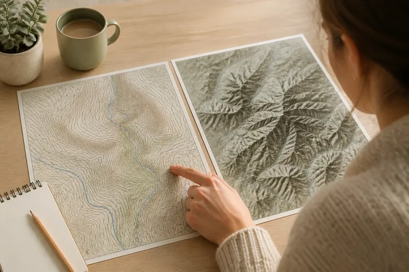
Mara begins with a county boundary layer, a stream layer, and a topographic map. Each answers a different question. The boundary layer depicts the county line as mapped; the stream layer shows watercourses; and the topographic map helps reveal slopes, valleys, and high ground.
Putting those layers together can explain the apparent mismatch without resolving every legal detail. The stream bends toward the bridge, while the county line crosses a field along a straighter segment. Farther upstream, the boundary approaches the ridge crest, then turns toward the river again.
A map’s scale matters. At a small scale, a line may be simplified so it remains legible beside roads and labels. At a larger scale, the mapped boundary may appear to sit on one bank, the channel center, or a nearby parcel edge. Those differences may reflect the map’s purpose and source rather than a deliberate claim that the terrain has changed.
For a first reading, Mara notes what each layer actually depicts instead of blending them into one picture. A transparent overlay can help, much like holding a clear sheet over a paper map: it lets the reader compare patterns while keeping the underlying features distinct.
Why a line can turn
Political boundaries are chosen or recorded by people, not generated automatically by slopes and waterways. A line may follow a river because the channel offered a recognizable divider when the boundary was described. Elsewhere, surveyors or officials may have used a straight course, a property edge, a road, or a defined point to make the division clear.
That history can produce a boundary with more than one kind of segment. It might track a stream through one valley, cross a plain in a straight line, and then meet a ridge. The change does not mean the terrain has failed; it means a political division was shaped by decisions that were not limited to terrain.
Local geography can also complicate a seemingly simple description. A river that once served as a dividing feature may now have a different channel, while a road or bridge may lead people to assume the county line follows the modern route. The visible landscape can preserve the broad logic of a boundary without identifying its exact course.
In Mara’s case, the straight segment across the field may reflect a surveyed course, while the nearby stream gives a more intuitive sense of the surrounding valley. She can use both facts: the stream explains the setting, and the mapped line shows where the boundary is represented in that source.
Check the evidence
When a boundary location matters beyond general orientation, Mara needs a source intended to represent that boundary, not just a landscape map. County or state mapping offices may provide official boundary records or direct readers to the relevant source. A parcel map can show property divisions, but property lines and county lines are not interchangeable.
She should compare the boundary layer’s metadata or accompanying notes with the map’s date, scale, and stated purpose. If the line is described as approximate, generalized, or suitable only for reference, that qualification matters. A digital map’s precise-looking edge can still reflect an underlying source with limited positional detail.
For a question about a specific parcel, address, tax jurisdiction, or legal responsibility, a general map may not settle the matter. Local rules and the authoritative record apply, so a reader who needs a binding answer should contact the relevant county office or a qualified survey professional.
Say Mara wants to tell a neighbor which county maintains the bridge near the stream. She checks the county’s boundary map and reads its notes, then contacts the appropriate public works office with the bridge location. The expected observable result is a clearer identification of the responsible office, rather than an unsupported conclusion drawn from the river’s path alone.
Questions about terrain?
Does a river always mark the county line?
No. A boundary may follow a river for part of its course, leave it at a bend, or lie nearby without matching the current channel. Treat the river as an orientation clue and consult a boundary source for the mapped or legally recognized line.
Can a ridgeline be a boundary?
Yes, a boundary can follow a ridge or watershed divide, but the crest may be difficult to identify from the ground. Topographic contours can show the shape of the land, while the county boundary record is needed to see whether the political line follows that feature.
Why do two maps show different lines?
Maps may use different source records, scales, dates, or levels of generalization. Compare their purpose and notes before assuming that one depicts a change in the boundary itself.
Which map should I trust for an address?
Use the county or other public office responsible for the specific service or jurisdiction, and ask what source it uses. A road map or online boundary overlay can orient you, but it may not answer a parcel-level or legal question.
Keep the clues separate
Mara finishes with a more useful picture than a single line on a screen: the stream identifies the valley, the ridge explains the surrounding slopes, and the county boundary layer records a political division that crosses both in places. She can describe where these features meet without claiming they are identical.
That distinction is the central lesson of reading county boundaries. Let rivers and ridgelines guide your eye, then check whether the recorded line actually follows them. When terrain and boundary part ways, the difference is not a flaw in the landscape; it is a reminder that a county line belongs to a system of records as well as to a place.
Near the end of any map search, return to the main question: are you trying to understand the shape of the land, or to identify the county boundary? For broad orientation, terrain can be enough; for a consequential location, the right boundary record and the responsible local office matter more than a convincing bend in the river.